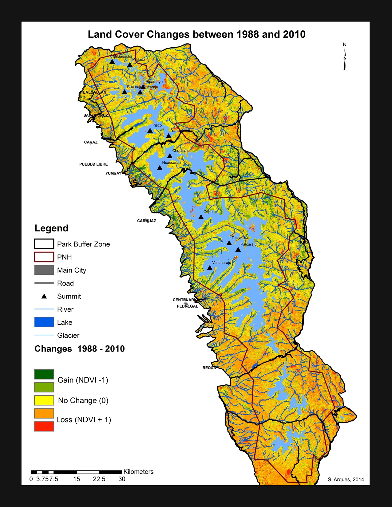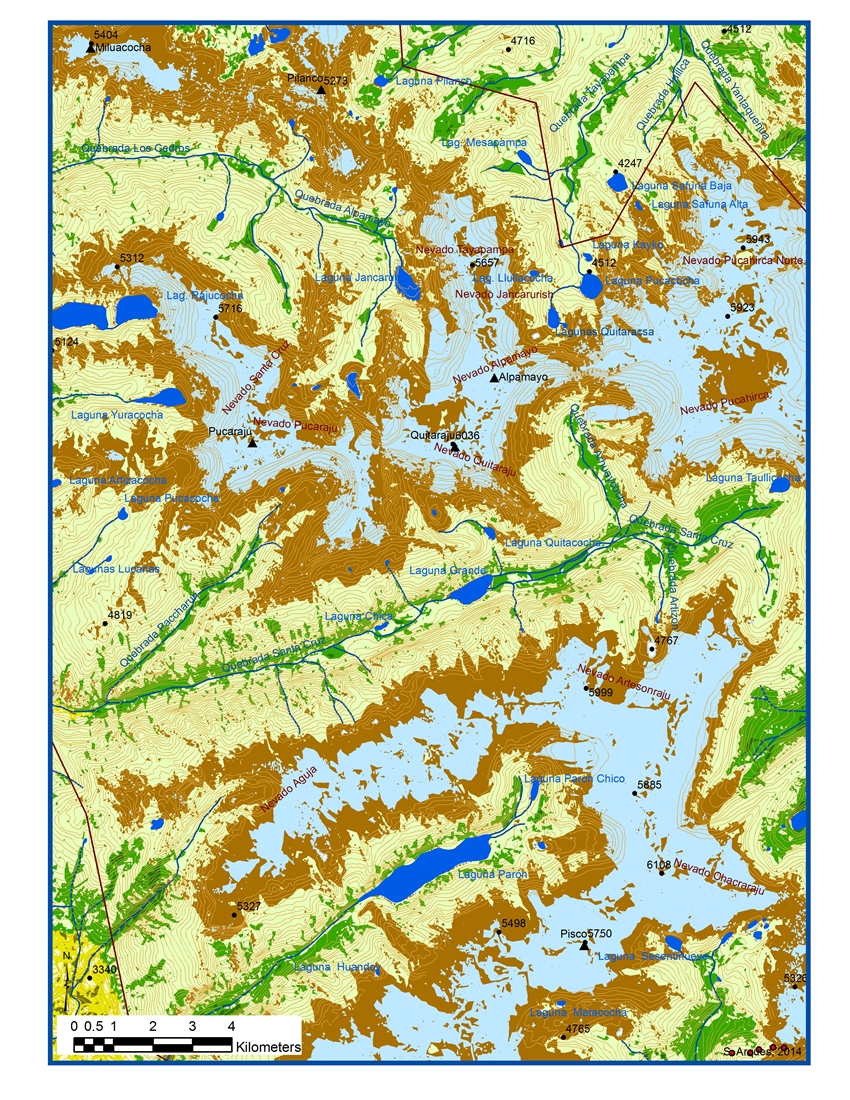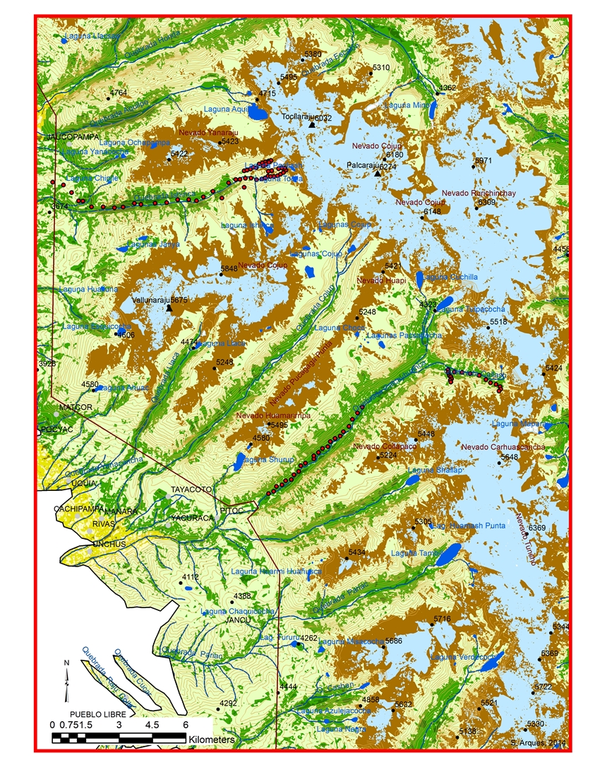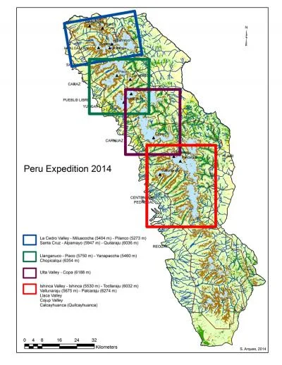

This project examines land cover/land use changes for the past forty years in Huascaran National Park and the adjacent communal areas. There is a wealth of satellite imagery available for the Cordillera Blanca, but it needs to be verified on the ground. We visit multiple valleys and peaks to collect information on the surface characteristics including slope, aspect, soils, disturbances, fire evidence, grazing impacts, insect damage, vegetation species, vegetation health, and other vegetation information. Ground control point (GCP) data is collected to calibrate the satellite imagery and evaluate human impacts on the landscape. In the absence of measurable human disturbances, climate changes should be responsible for the remaining vegetation variability. Areas of high human-induced impacts such as fire or grazing are compared to more remote areas with fewer disturbances to evaluate climate versus anthropogenic drivers for change. Finally, slope and aspect data will be collected to facilitate verification of ASTER and SRTM global DEM products. Once the relative importance of human disturbance on the landscape has been evaluated, the Park managers and other stakeholders can devise more effective resource management strategies to address long-term ecosystem stability in the face of global climate change.